As the calendar winds down, the wintry weather is winding up, with freezing rain, rainfall, and strong winds across much of the Greater Toronto and Hamilton Area.
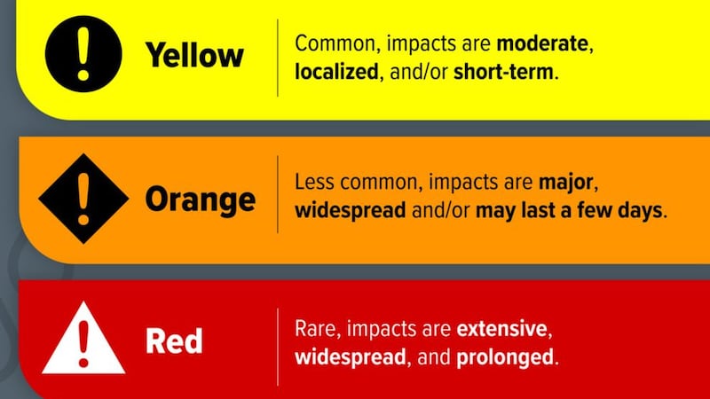
Currently, Environment Canada has issued several yellow and orange warnings for a number of parts of Southern Ontario, with 20 to 40 millimetres of rain and freezing rain expected between Sunday afternoon and Monday morning as well as strong wind gusts of 70 to 90 km/h.
The national weather agency said the freezing rain could lead to some icy surfaces with build-up of 4 to 8 mm, especially north of Highway 401.
The freezing rain is expected to end later this evening or overnight and should change over to rain “as temperatures climb above the freezing mark.”
“Areas along the Lake Ontario shore will see little to no ice build up,” the agency said, noting roads and walkways will likely become icy and slippery.
“Icy surfaces could be difficult to detect. Be very careful if walking or driving.”
Environment Canada has also issued a special weather statement for several areas due to the wind.
The affected local regions include Toronto, Burlington-Oakville, Caledon, Hamilton, Dunnville-Caledonia-Haldimand, Halton-Hills Milton, Mississauga-Brampton, Newmarket-Georgina-Northern York Region, Niagara Falls-Welland-Southern Niagara Region, Pickering-Oshawa-Southern Durham Region, St. Catharines-Grimsby-Northern Niagara Region, and Vaughan-Richmond Hiill-Markham.
It should also be noted that the Town of Aurora has declared a significant weather event, effective at 10 a.m. on Sunday until further notice, due to Environment Canada’s freezing rain warning.
“Freezing rain is expected from midday Sunday into early Monday, making roads, sidewalks, multi-use paths, bike lanes, and laneways slippery and hazardous,” the municiality’s mayor wrote in a post on X.
“Clearing may take longer than usual. Please use caution when travelling. ... Stay safe, Aurora.”
Toronto Pearson Airport is also urging travellers to check their flight status before making their way to the airpoort and allow for extra time on the roads.
We’re monitoring the weather as rain and freezing rain move across the Greater Toronto Area.
— Toronto Pearson (@TorontoPearson) December 28, 2025
While we don’t anticipate major disruptions to operations from today’s weather, please check your flight status before coming to the airport and allow extra time on the roads when… pic.twitter.com/MW0sr8LAeo
Here’s a breakdown of what you need to know:
Heavy rain and freezing rain on Sunday
Rain, heavy at times, is forecast to begin near noon today, initially falling as freezing rain in some areas before transitioning to rain later in the day.
Some roads may become impassable, particularly in low-lying areas, and residents are being advised to stay away from rivers, creeks and culverts.
“Rain and freezing rain will be heavy at times through the afternoon and evening,” Environment Canada said, noting conditions are expected to ease by Monday morning.
Freezing rain is in the forecast.
— City of Toronto 🇨🇦 (@cityoftoronto) December 28, 2025
Salt trucks are being deployed to expressways, major roads, sidewalks, bikeways, and residential areas, as needed.
Take care on the roads and sidewalks as they may be slippery.
To help reduce the risk of flooding as temperatures warm up… pic.twitter.com/73KsUJq3ey
In a statement provided to CP24 on Sunday afternoon, the City of Toronto said salt trucks are being deployed to expressways, major roads, sidewalks, bikeways, and residential areas, as needed.
“Take care on the roads and sidewalks as they may be slippery,” it advised.
“To help reduce the risk of flooding as temperatures warm up in the coming days, crews are clearing leaves from catch basins to help melting snow drain from the roads. If you see leaves blocking the sewer or catch basin near your property, clear them away, if it’s safe to do so.”
Warming centres and daytime drop-in centres are also open for vulnerable individuals, the city said.
Due to the weather, Warming Centres remain open:
— City of Toronto 🇨🇦 (@cityoftoronto) December 28, 2025
📍 136 Spadina Rd.
📍 81 Elizabeth St.
📍 12 Holmes Ave.
📍 885 Scarborough Golf Club Rd.
📍 349 George St.
Find locations using the map at https://t.co/tRpue1Palo
Daytime drop-in programs are also available across… pic.twitter.com/lj4p4pTUE6
Gusty winds to follow on Monday
A yellow warning along with a special weather statement are also in effect for Monday, with strong wind gusts of 70 to 90 km/h expected to develop in the morning as a strong cold front passes through.
The winds are projected to ease later in the evening as they shift to the northwest, but officials note, “areas that will receive ice accretion from freezing rain will be most vulnerable.”
There is also a possibility that some areas will see local utility outages along with damage to roofs, fences, tree branches, and soft shelters.
Environment Canada says residents should also secure loose any objects around them and continue to monitor weather alerts as conditions evolve.